
GALAXY G1 PLUS
In the form of the ubiquitous, internet is penetrating and fusion in all corners of the surveying technology, and setting off an unprecedented reconstruction and transformation.
In the dawn of a new era, south is walking in front of it to craft Galaxy 1plus which opening a '+' era of high-precision positioning applications.


Traditional surveying and mapping field: surveying application in traditional engineering construction projects, and small area topographic map surveying
Territorial survey: planning land ownership, resolving land disputes, etc., land contracted area calculation, rural land contract management right confirmation, registration, certification, mountain flood disaster survey evaluation, forestry resources survey, land area survey, and geological survey and agriculture investigation and data collection, illegal land use monitoring, mineral resource verification, land desertification survey, etc .;
Pipeline survey: the clear inventory of municipal pipelines, registered increments, and construction, design, line surveys, etc. in industries such as water, gas, and power;
Regional management: such as the monitoring and positioning of internal facilities and areas in cities, scenic spots, farms, forest farms, and nature reserves, as well as regional division management;
Location services: municipal facility positioning, urban component survey, etc .;
Teaching: Schools and majors involved in the above needs, purchase instruments for teaching and practice.
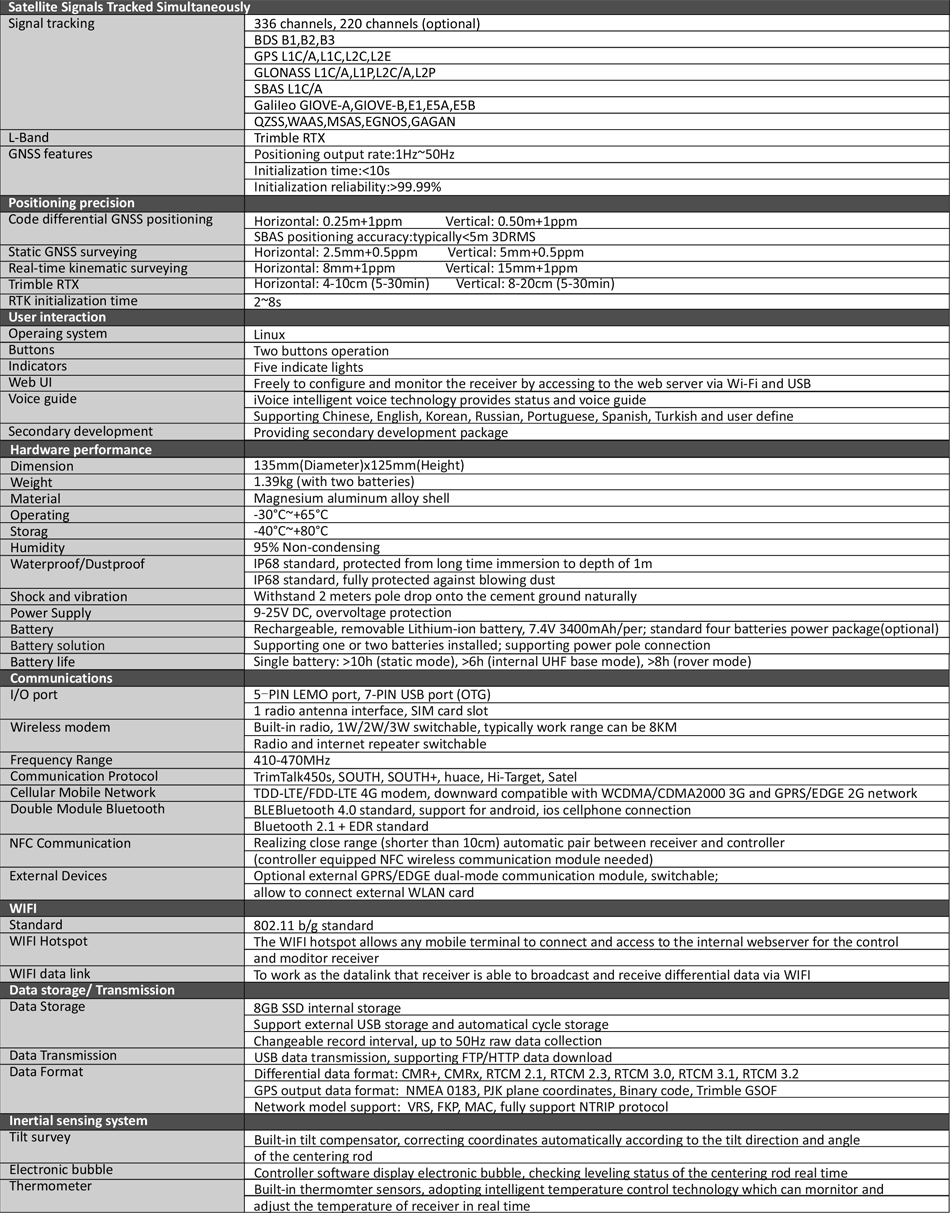
1. G1PLUS

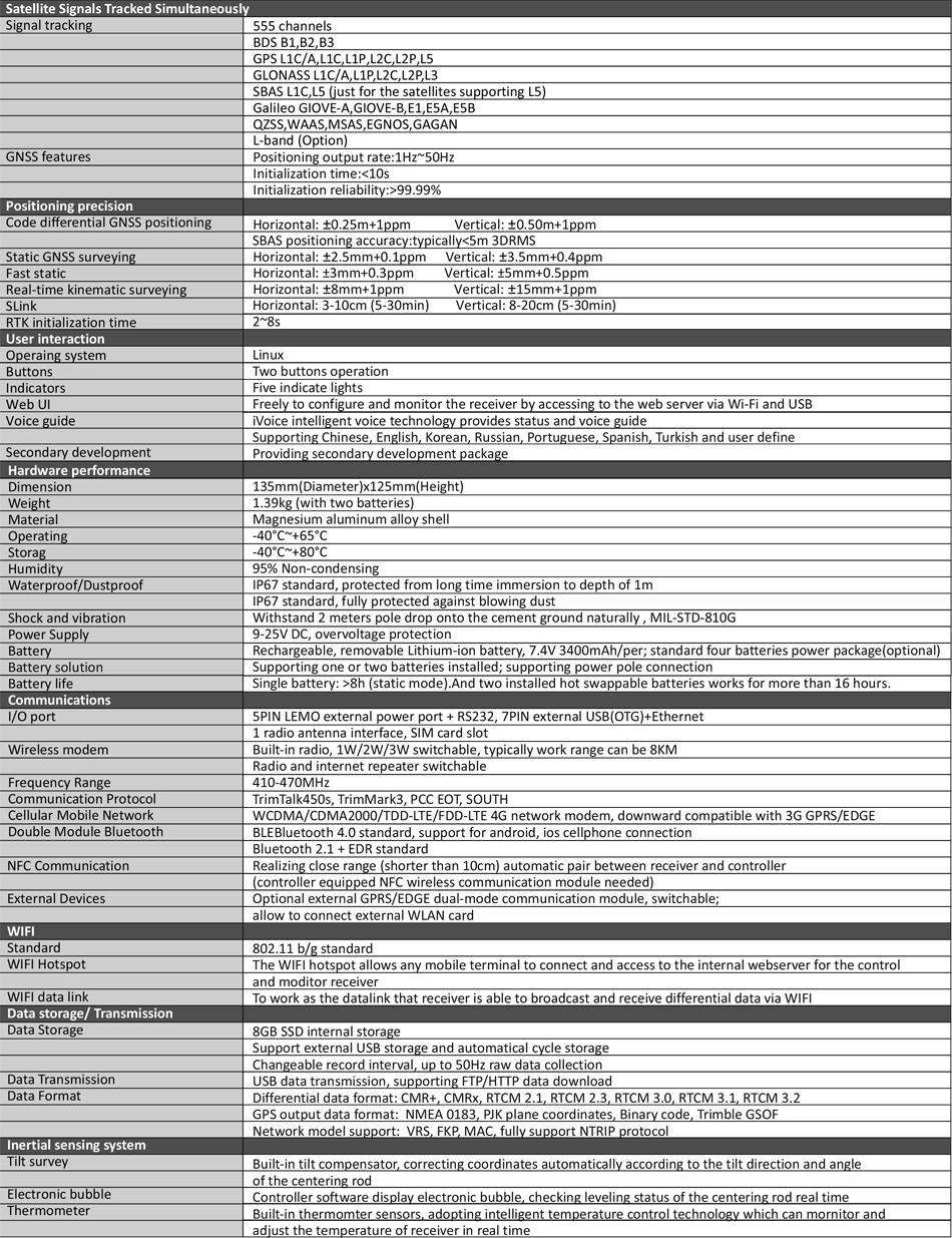
2. G1PLUS-555CHANNELS

This information is for reference only, in order to continuously improve product performance, all pictures and performance parameters on this website are subject to change without notice, please understand! The company reserves the final interpretation of all technical parameters and pictures.