Big News! South GNSS products contribute to Everest Elevation Survey
time: 2020-06-01 visits: 3560
2020 Everest Elevation Survey
A comprehensive surveying & mapping project Mountaineering representing the development of national surveying & mapping technology
A review of domestic surveying & mapping instruments and equipment to comprehensively undertake surveying tasks
A National action
An Industry feat
The heroical national surveying & mapping team once again lived up to expectations
SOUTH shoulders the mission, taking the responsibility when the country, industry, and users need SOUTH!
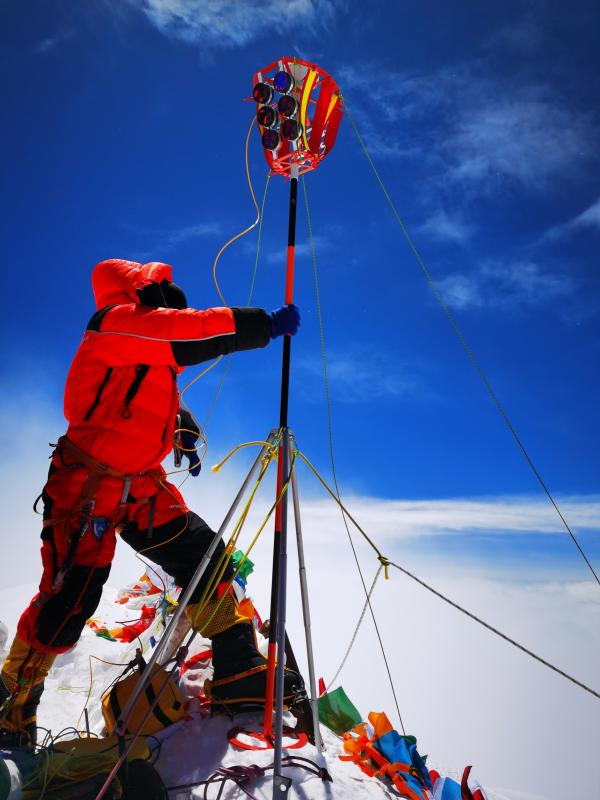
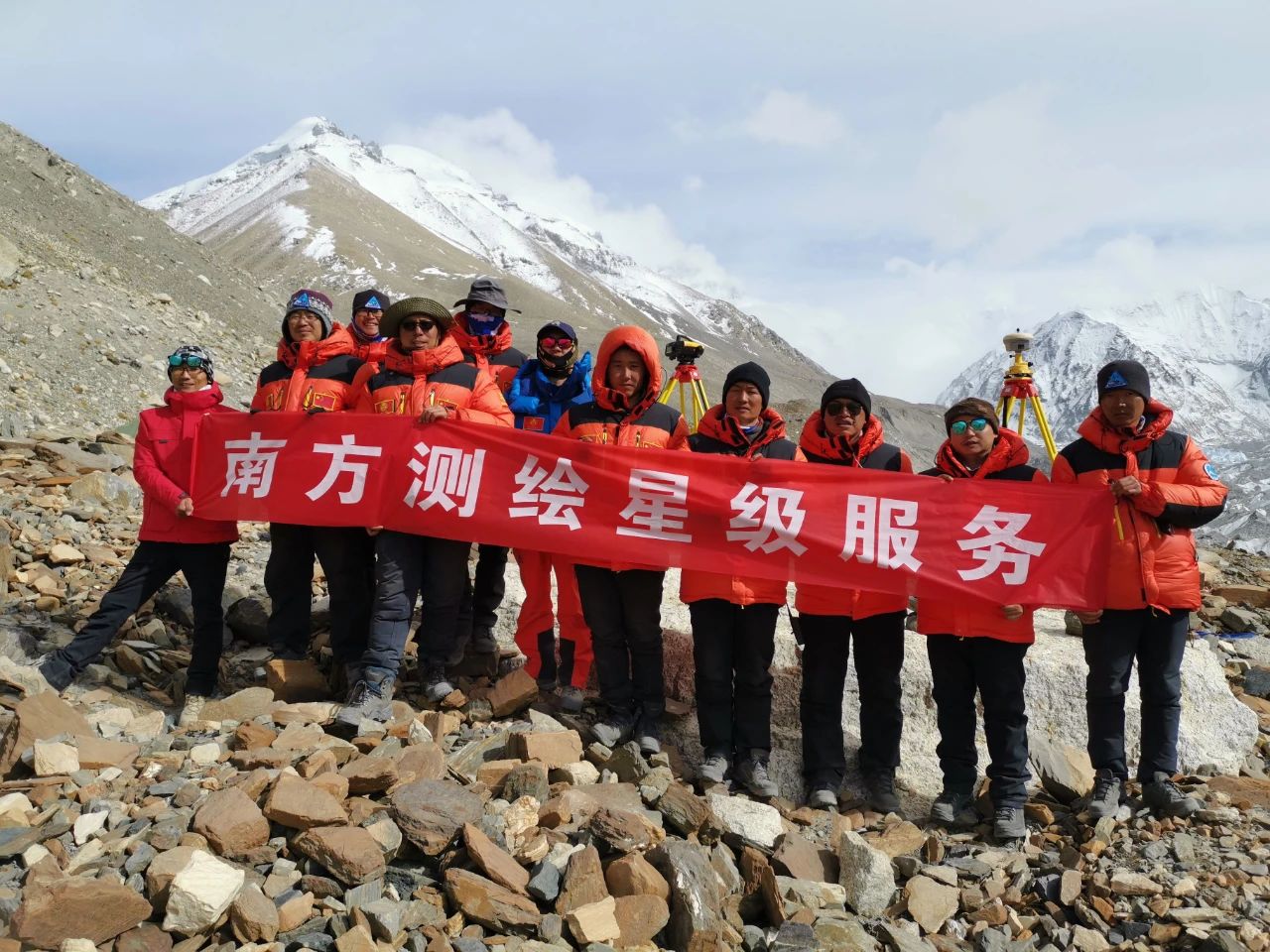
At 11 am on May 27, the 2020 Everest Surveying team successfully summited Mount Everest. They set up targets on the peak and carried out various surveying work.
Eight members of the team set off from the assault camp at an altitude of 8300 meters at 2:10 am today, taking nearly nine hours to reach the summit.
The “Plateau Glacial Detection Radar System”, customized and developed by SOUTH and China Electronic Technology Group Corporation 22nd Research Institute, and the target, customized by Changzhou Accessories Factory of SOUTH, reached the summit of Everest, which have become indispensable equipment for the Everest elevation survey.
2020 Everest elevation survey is organized and implemented by the Ministry of Natural Resources, in conjunction with the Ministry of Foreign Affairs, the State Sports General Administration and the Tibet Autonomous Region Government. This year is the 60th anniversary of the first human’s climbing to the top of Everest from the northern slope, and the 45th anniversary of the first accurate determination and announcement of the Everest height in China, for which carrying out Everest elevation survey is of great historical significance.


The preparatory work for Everest elevation survey was launched in 2019. At the same time, it is clear that it will achieve technological innovation and breakthroughs in five aspects, including "domestic surveying and mapping equipment fully fulfill this surveying task."
SOUTH actively responded to the call, maintained communication with the participated national surveying & mapping institutions, and took the initiative to mobilize the group's technical strength to overcome scientific research problems, successfully accomplishing the customized R & D tasks of “Plateau Glacial Detection Radar System” and the “target”.
The indispensable equipment---- Plateau Glacial Detection Radar System
Plateau Glacial Detection Radar System mainly uses the antenna to transmit and receive high-frequency electromagnetic waves to detect the ground snow depth. The thickness of the snow and ice layer on Mount Everest is obtained through Rader observation, and is deducted from the snow surface altitude of Mount Everest to acquire the rock surface altitude of Mount Everest, which is commonly known as the “Everest height”.
Compared with the snow depth radar detector used in the Everest elevation survey in 2005, “Plateau Glacial Detection Radar System” has plenty of highlights: ① Lighter weight. The overall weight does not exceed 5kg, including integrated radar host, transceiver antenna, GNSS, power supply system, storage equipment and other components; ② National production of radar and GNSS. Radar detection depth ≥ 5 meters, detection accuracy <5% * D (D is the detection depth); GNSS, with real-time positioning and recording data, can realize continuous operation in -40 ℃ ultra-low temperature environment; ③ High integration. System is fully integrated inside radar to realize time synchronization and position synchronization. Each radar data has corresponding GNSS data corresponding to and stored; ④ Faster data calculation.

Huagang Bai, director of the No.1 Geodetic Team of the Ministry of Natural Resources, who participated in the Everest elevation survey in 2005 and in 2020, said: The snow depth radar detector used in 2005 is connected with GNSS by a line, which is unable to achieve time synchronization and position synchronization. Although GNSS has been surveying, it is necessary to mark the GNSS time point and then correspond to the radar time to simultaneously obtain GNSS data and radar data at a certain time, which is relatively complicated. It is precisely because the time synchronization and position synchronization are not achieved that the efficiency of later data calculation is reduced.
Yongxiang Ding, deputy chief engineer of South GNSS Navigation, said: According to the special requirements of Everest elevation survey, SOUTH and the 22nd Institute jointly stablished a glacial radar technology group to develop a "Plateau Glacial Detection Radar System", which includes the first stage of design and demonstration, the second stage of design and production, the third stage of the whole machine test, the fourth stage of multiple customized machine test, and final stage of comprehensive low temperature plateau on-site measurement.
Shaohua Cheng, a South GNSS technician who has experienced the whole process, recalled the various scenes of the research: The Surveying & Mapping Department repeatedly and extensively tested the disassembled motherboard, antennas, and collects data, and tested and analyzed the data in different environments; R & D Department III customized software modules embedded in the motherboard to solve the 50Hz acquisition problem and data quality problem; R & D Department II jointly solved the problem of signal shielding and anti-interference; R & D Department III solved the synchronization problem of the positioning device time and the radar acquisition time; in addition, the cables and connection ports are specially customized to solve the problem of signal transmission ...
"At the critical point of research, everyone was affected by the coronavirus, and some technicians were quarantined.” Yongxiang Ding said, “Work remotely was the only choice for they couldn’t meet each other. They tested and improved products again and again, accelerating the process and solving the problems to ensure the equipment is supplied on schedule and with high quality.”
